 Add My Company
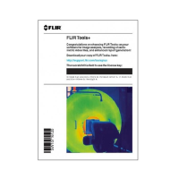
FLIR Tools+ Reporting Software
Product Code: TOOLS+

FLIR Tools+ Reporting Software
Building on the excellent reputation of FLIR Tools and FLIR Reporter Professional is the all new FLIR Tools+.
With the upgrade a thermographer can perform all the tasks previously possible plus a host a helpful new functions.
IR and manual images can now be grouped manually, independent of when or how the images were taken. This is useful for entry-level cameras which can only take IR images, or for operators who prefer to take reference images on a separate camera. The software allows any images to be grouped together then included in the report.
Radiometric panoramas are created easily thanks to the additions of FLIR Tools+, Including Multi-Spectral Dynamic Imaging ensuring you can thermally map large areas in one full scene. The settings of the resulting panorama can still be adjusted and the image further analysed.
Creating thermal videos is easier than ever with the new software. Added functionality allows the user to create time lapse videos, highlighting thermal trends over a longer period while saving disc space.
Improved report creation simplifies the process of producing concise, professional and customised documents. With many PDF and Microsoft Word report templates available, all of which can be customised with your company logo, you’ll never be stuck without the perfect solution to present your measurements. The new Word Add-In will also let you create a report in word and continue to fine tune the images just as in the FLIR Tools+ Software.
Key Features
- Manually group IR and regular images
- Create IR Panoramas (including MSX images)
- Record IR video and create time lapse videos
- Edit images in Microsoft Word reports with new Add-in
- Import, search, filter, and view FLIR JPEG images directly from your FLIR handheld camera via USB cable or by downloading from the SD card
- Edit radiometric images to thermal tune level and span, change the palette, or adjust parameters such as emissivity and reflective temperature
- Add measurement tools – spots, area boxes, circles, lines, Delta T
- Add text annotations and edit image descriptions
- Create professional PDF image sheets and reports
- Add headers, footers, and logos
- Create, import, edit and export templates
- Choose a report format: horizontal IR + DC or vertical IR + DC
- Edit MSX images and “Sketch on IR/Visual” images
- Display stored compass and GPS information
- Export reports to print or email for easy sharing
For more information on FLIR Tools+ Reporting Software talk to www.test-meter.co.uk

